Wedding Star Map: the Sky and the Moon the Night You Said “I Do”
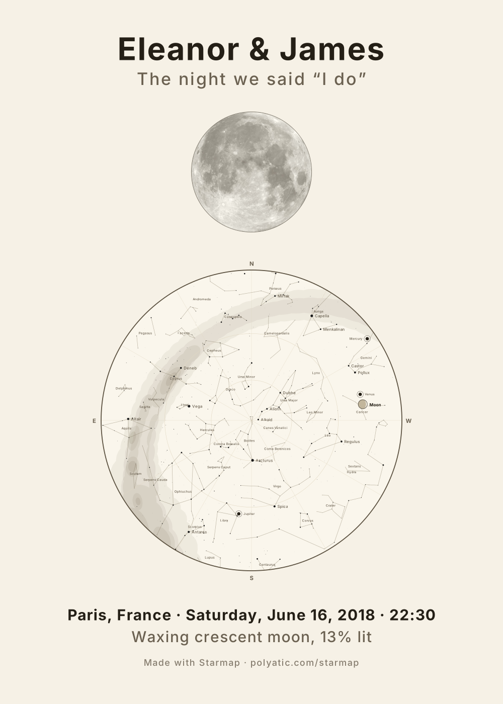
On a star chart the Moon is a small labelled disc, easy to miss. The Sky + Moon poster draws the wedding night twice over: the round chart of every star over the venue, and above it the Moon itself, large, lit to its phase and turned the way it hung in that sky. One title, one line for the place and date, and the phase in words underneath.
Make our sky and Moon
Free, no account, nothing to buy. Opens the Sky + Moon layout in the ink theme; One sky and Two skies are a tap away under Layout.
What the Moon half shows
- Its face, from NASA’s lunar albedo map, so the seas and craters are where they are on the real Moon.
- Its phase for that minute: the sample’s 13 % waxing crescent, and the phase line printed in words (“Waxing crescent moon, 13% lit”).
- Its tilt: the lit side faces the Sun as seen from the venue, so a crescent over Paris and the same crescent over Sydney lean opposite ways.
- Where it was, if it was down: a Moon below the horizon at your minute is drawn as it rose, with a line such as “Below the horizon at 22:30 · drawn as it rose at 04:12, in the east”, so the poster never pretends.
How it sits on the sheet
On every portrait print, from A4 to 70 × 100 cm, the Moon stands above the chart; on the landscape desktop sizes and the square post they sit side by side. The Moon is never smaller than 40 % of the chart’s radius nor larger than 85 %. Both halves are computed for the same moment and place, and the chart keeps everything the one-sky poster has: the Milky Way, the planets, constellation names, your caption.
Picking the minute
The vows, the first dance, or midnight: the sky turns about 15° an hour, so any minute that evening gives a similar chart, while the Moon’s phase barely moves (it grows about 12° of its cycle a day). An afternoon ceremony can still be the poster: the stars are drawn where they stood in daylight and the caption says it was daylight, or one button moves the time to the first fully dark minute of the evening. A month either side changes the Moon completely, which is why a wedding-night Moon is worth having.
For two nights on one sheet (the night you met above, the wedding below), choose Two skies and A different night under Layout; the memorial page walks through that layout with an example.
What the chart draws
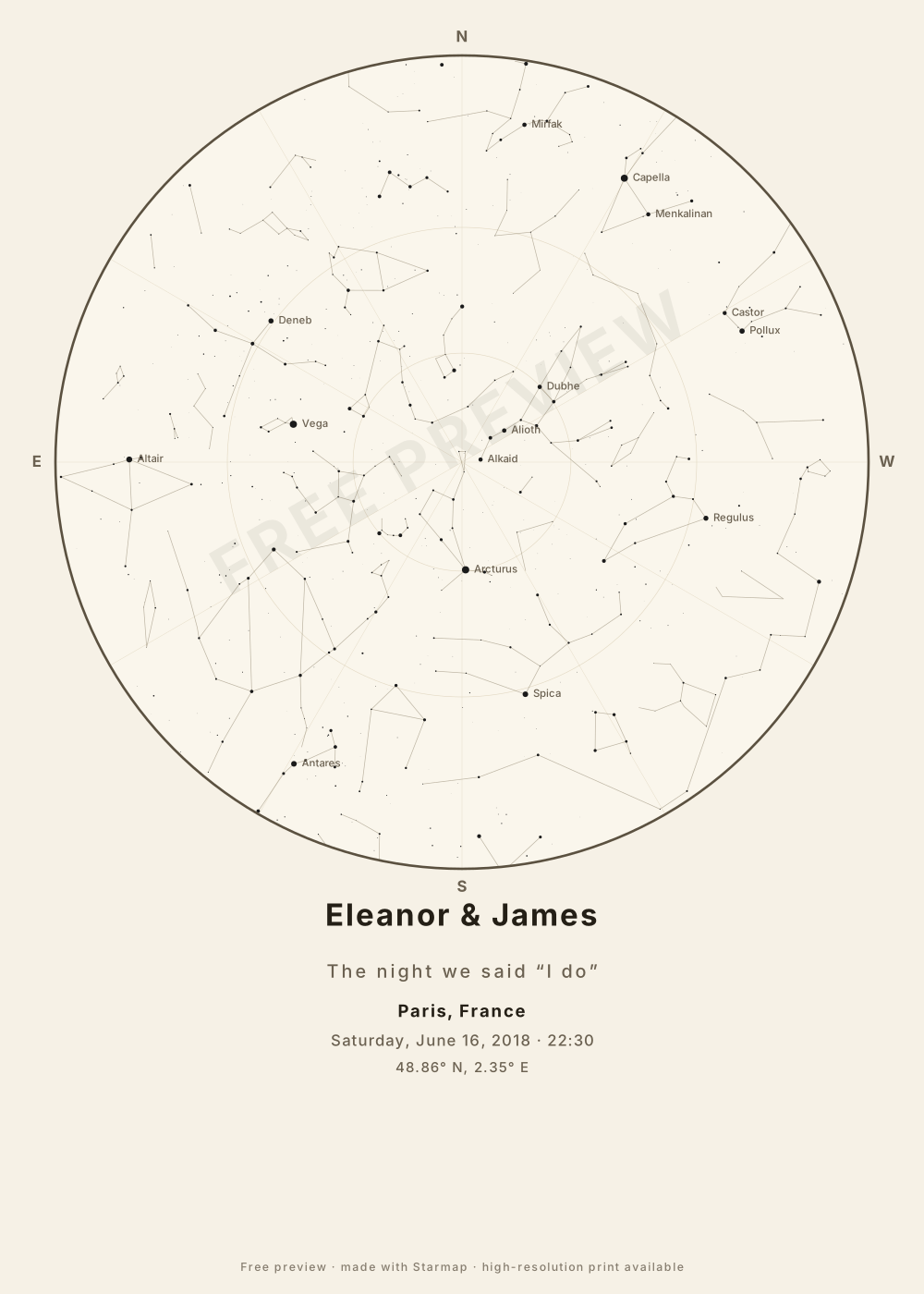
The chart holds the 1,630 stars brighter than magnitude 5.0 and the 89 constellation figures, and the Milky Way is drawn as a soft band. The Moon is drawn in its real phase, and left off when it was below your horizon. The five naked-eye planets, Mercury, Venus, Mars, Jupiter and Saturn, are drawn where they stood. The Sun is drawn too whenever it was up, and the caption says whether your moment was daylight, twilight or full dark: the stars are always drawn where they stood, even when daylight or twilight hid them. So is an eclipse, if your moment falls inside one. Uranus, Neptune and 133 deep-sky objects are one switch away: tick Deep-sky objects and the chart marks the Messier objects and southern showpieces and adds Uranus and Neptune (see them over London on a winter evening). Great comets since 1900 can be added (Hale-Bopp over London, 1997). Not drawn: faint comets and satellites, whose orbits this tool does not compute. Every position is carried to your date by precession. Not modelled: the stars’ own proper motion. A date before 15 October 1582 is read in the Julian calendar. It all runs in your browser, nothing is uploaded, and the downloads are complete and free. Accuracy, print sizes and privacy, answered in full.
Common questions
There was no Moon on our wedding night. Is the poster empty?
No. If the Moon was below the horizon, it is drawn as it rose, with that time and direction printed. Near new Moon it is a thin dark disc with a sliver of light, and the phase line says how much was lit. If you would rather not show it, the One sky layout is the chart alone.
Which theme suits a wedding?
Ink on paper is the usual choice for a frame: dark marks on warm white, close to a letterpress print, and the cheapest to print. The navy night theme makes the Moon glow against a dark sheet.
Can I add a longer dedication under it?
The title and subtitle are yours, at any length that fits the line. The three-line dedication field belongs to the one-sky poster, where there is room for it under the caption.