A Printable Constellation Map, Every Figure Named
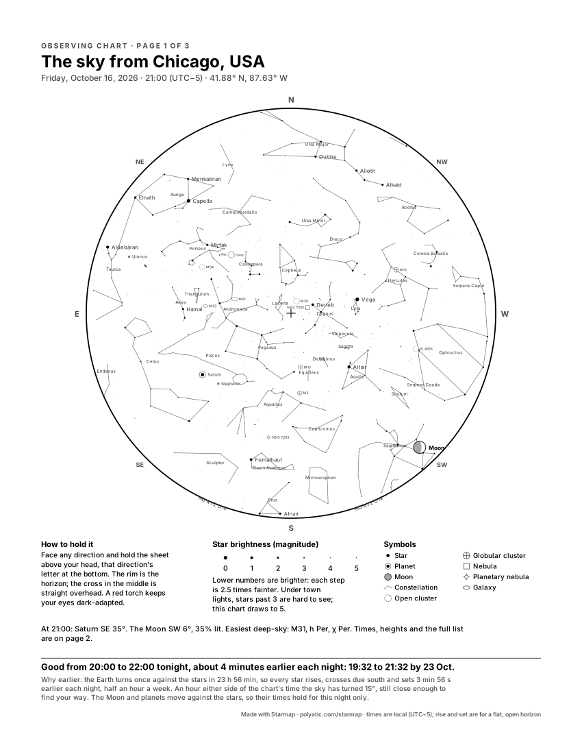
A constellation map earns its paper outside, held up against the real sky. The Observing chart is built for that: every constellation figure above your horizon at your hour, drawn in black on white so a home printer handles it, each figure named, the brightest stars named, and a second page that lists what is up tonight and where.
Print my constellation map
Free, no account, nothing to buy. Opens the Observing chart; Download PDF writes both pages, on A4 (21 × 29.7 cm) or US Letter (8.5 × 11 in).
Which figures, and how they are named
The generator carries all 88 IAU constellations as 89 drawn figures (Serpens comes in two halves, Caput and Cauda). For your date, time and town it draws every figure that is at least partly above the horizon and clips it there, so a rising Orion shows only the stars of Orion that are up. Usually that is 25 to 45 figures at once, depending on latitude and hour; near the equator a few more, because no part of the sky is hidden there for good.
Names come in two forms, picked under Star-chart names:
- Latin (IAU), the default: Ursa Major, Cygnus, Scorpius, as every star atlas prints them in every country.
- Poster language: the names learned at home, for a poster set in German, Danish, French, Spanish, Swedish, Norwegian or Dutch: Großer Bär, Store Bjørn, Grande Ourse, Osa Mayor, Grote Beer. An English poster keeps the Latin names (the menu says so: English, Latin only).
Each name is set small at the middle of the part of the figure that is above your horizon. Two rules keep the sheet readable: a name is left out rather than printed over a star’s name already there, and left out rather than cut off by the rim. On a London chart for 21:00 on 15 January 2024, 36 of the 40 figures on the disc got names; Lyra lost its space to the word “Vega”. The figures themselves are always drawn.
What the two pages hold
Page 1 is the chart, as large as A4 or US Letter allows, with the horizon at the rim and east on the left, the way the sky looks when you hold the sheet overhead. Under it: how to hold it, a key to star sizes by magnitude, a key to the symbols, and the hours this week the chart still matches (an hour either side of your time, while the Sun is at least 12° down; a star rises about four minutes earlier each night). Page 2, “Tonight from” your town, lists the Moon, every planet that is up, the six brightest named stars at least 15° high, and 8 to 12 deep-sky targets at least 25° high, each marked naked eye, binoculars or small telescope. Download PDF writes both pages; the PNG and SVG are page 1.
For a framed keepsake rather than a field chart, the ordinary one-sky poster draws the same figures and names in any of the themes and sizes.
What the chart draws
The chart holds the 1,630 stars brighter than magnitude 5.0 and the 89 constellation figures, and the Milky Way is drawn as a soft band. The Moon is drawn in its real phase, and left off when it was below your horizon. The five naked-eye planets, Mercury, Venus, Mars, Jupiter and Saturn, are drawn where they stood. The Sun is drawn too whenever it was up, and the caption says whether your moment was daylight, twilight or full dark: the stars are always drawn where they stood, even when daylight or twilight hid them. So is an eclipse, if your moment falls inside one. Uranus, Neptune and 133 deep-sky objects are one switch away: tick Deep-sky objects and the chart marks the Messier objects and southern showpieces and adds Uranus and Neptune (see them over London on a winter evening). Great comets since 1900 can be added (Hale-Bopp over London, 1997). Not drawn: faint comets and satellites, whose orbits this tool does not compute. Every position is carried to your date by precession. Not modelled: the stars’ own proper motion. A date before 15 October 1582 is read in the Julian calendar. It all runs in your browser, nothing is uploaded, and the downloads are complete and free. Accuracy, print sizes and privacy, answered in full.
Common questions
Are the constellation names on by default?
On the Observing chart they always are: it names every figure, whatever the checkbox says. On the posters, Constellation names is ticked when the generator opens; untick it for a quieter print, and the figures stay drawn.
Will my zodiac constellation be on a birthday chart?
Usually not, and that is real astronomy: a sun sign is the constellation behind the Sun on that date, so it is up in daylight and down at night. Make the chart for a date about six months later to see it high in the evening.
Why is east on the left?
Because you read a sky chart looking up. Lying on your back with your head to the north, east is on your left, the mirror image of a ground map. Hold the sheet over your head with the compass letters matching the real directions and the figures line up with the sky.